Last updated: 11 October 2026, 2:15am BST
Hurricane Isaias has weakened to a post-tropical cyclone after making landfall near Destin, Florida, but flash flooding and recovery problems remain across the south-eastern United States. At least four deaths have been reported and hundreds of thousands of customers lost power.
At a glance
- Isaias made landfall near Destin at about 9.30pm EDT on Friday 9 October as a Category 2 hurricane with sustained winds of 105mph.
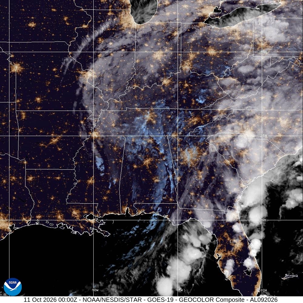
- NOAA’s latest storm page placed the weakened centre over Alabama at 9pm UTC on 10 October, with sustained winds near 30mph.
- AP and Reuters reported at least four deaths and very large power outages across Florida and neighbouring states.
- Federal emergency declarations were approved for Florida and Alabama, while inland flood risks continued.
What changed after landfall
Florida’s official recovery update says wind gusts reached 116mph near Santa Rosa Sound and water at Panama City Beach rose about 5.6ft above the average high-tide level. The state declared an emergency in 27 counties and positioned more than 16,000 utility workers and restoration personnel.
At 7am on Saturday, Florida reported 448,298 customer accounts without power. Later reporting by Reuters put the number still without electricity across Florida, Alabama, Georgia and Mississippi at about 670,000. The figures refer to different times and areas, so they should not be treated as a contradiction or combined into a single total.
The NOAA/NESDIS storm tracker said Isaias had maximum sustained winds near 30mph by 9pm UTC on Saturday as it moved north-north-east through Alabama. The system was no longer a hurricane, but the agency’s message still warned that flash-flood risk continued across the south-east.
Deaths and damage
AP and Reuters reported at least four deaths linked to the storm, including fatalities caused by falling trees and carbon-monoxide poisoning. Initial reports also described damaged homes, airports and infrastructure, blocked roads and wide power losses.
Early numbers are provisional during an active recovery. Damage totals, outage counts and casualty figures can change as local agencies complete assessments, so claims circulating on social media should be checked against state emergency agencies and the National Weather Service.
What people in affected areas should do
- Follow local National Weather Service warnings even if the cyclone’s wind classification has been downgraded.
- Never drive through flood water; depth and road damage can be hidden.
- Operate generators outdoors and well away from windows to prevent carbon-monoxide poisoning.
- Use official county or state channels for shelters, road closures and water notices.
- People outside the US checking on relatives should use direct contact and local emergency pages rather than sharing unverified rescue posts.
Brighton Locals’ view
The central lesson is that “weakened” does not mean “over”. Wind speed is only one hazard. Flooding, damaged power networks, unsafe generators and blocked roads often cause the most persistent risk after landfall.
Officials should keep publishing time-stamped numbers with clear geographic coverage. When outage figures differ by hundreds of thousands, readers need to know whether the difference is timing, geography or methodology.
What to watch next
The immediate questions are the path of heavy rain through Georgia and the Carolinas, the speed of power restoration, confirmed damage assessments and whether federal assistance expands beyond emergency response into longer-term recovery.
Bottom line
Isaias is no longer a hurricane, but its consequences are still unfolding. Inland flooding and safe recovery work now matter more than the storm’s former category.
Related global context: UNCTAD’s 2026 global growth outlook.

Leave a Reply