Last updated: 14 October 2026, 5.46am BST.
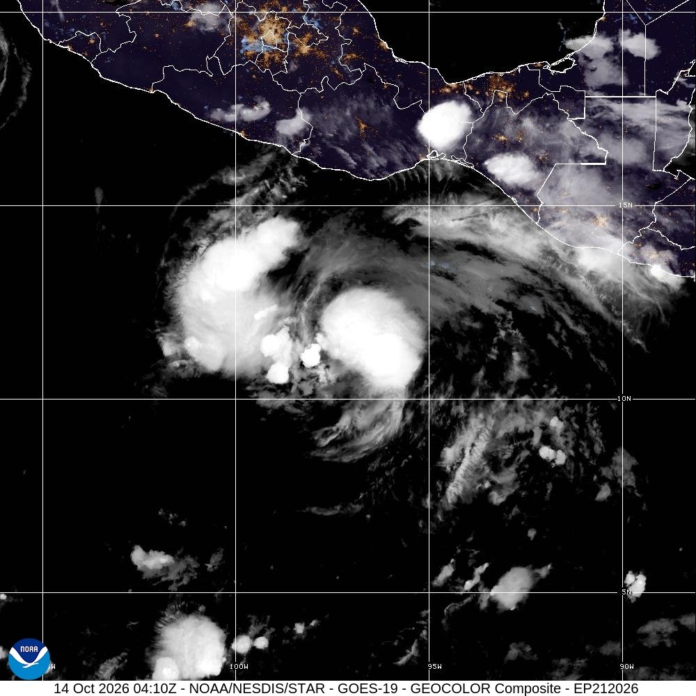
The Tropical Storm Trudy Mexico forecast now calls for rapid strengthening, with a hurricane expected by Wednesday night, 14 October, and a major hurricane by Friday, 16 October 2026. At the National Hurricane Center’s 4am BST advisory on 14 October, Trudy was still a tropical storm with 45mph sustained winds, south-southeast of Acapulco.
In short
- The 03:00 UTC advisory, 4am BST on 14 October, put winds at 45mph, or 75km/h.
- Trudy was about 705km south-southeast of Acapulco and moving northwest at 10mph.
- No coastal watches or warnings were in force in that advisory.
- Rapid strengthening is forecast; the next complete advisory is due at 10am BST.
Tropical Storm Trudy Mexico forecast: what is new
The NHC’s advisory number 3 says coastal watches are likely to be needed on Wednesday for parts of southwestern and west-central Mexico. Those watches had not been issued in this bulletin. Residents and visitors should distinguish a forecast of future danger from the warning status at the time of the advisory.
The same bulletin expects swells to start affecting parts of southern Mexico’s coast late this week, with potentially life-threatening surf and rip currents. It does not establish that all Mexican resorts are currently affected or that flights have been cancelled.
What remains uncertain
The NHC’s accompanying forecast discussion reports higher-than-normal track uncertainty from about 72 hours onward. Weak steering and differences between forecast models matter. The official forecast brings Trudy inland over western Mexico later in the weekend, but the forecasters warn that the amount of land interaction could substantially change its later survival and strength.
A precise landfall location, time or final impact should therefore not be treated as settled. Nor does the large cloud pattern in the satellite image mean the strongest winds extend across the whole visible circulation.
Why this matters to Sussex readers
This is relevant to people with travel plans or family on Mexico’s Pacific coast, not a forecast for Brighton. Trudy is a separate cyclone from Hurricane Simon, which we report on separately. Do not transfer Simon’s island watch to Trudy or treat the two storm names as interchangeable.
What travellers should do
Check the NHC’s live storm page for the latest advisory and warning areas. The FCDO’s Mexico advice tells British travellers to follow local authorities and tour operators, including evacuation orders. That is standing travel guidance, not a newly announced Trudy travel ban.
If you are on the Pacific coast, ask your accommodation or operator what local instructions apply and how it will communicate changes. Follow local beach restrictions; do not use the absence of a coastal watch in an earlier bulletin as proof that swimming remains safe.
Brighton Locals’ view
The strengthening forecast warrants early preparation, while the uncertain track argues against dramatic, precise landfall predictions. The evidence that would change this assessment is a new advisory fixing warning areas or substantially revising the track and intensity.
What to watch next
The next complete NHC advisory is scheduled for 3am CST, equivalent to 09:00 UTC or 10am BST on 14 October. Check especially for the first coastal watches and changes to the forecast beyond three days.
Bottom line
Trudy is not yet the major hurricane in the forecast. The useful response is to prepare for the risk without pretending the details are already certain.
Featured image and source
Tropical Storm Trudy in GOES-19 GeoColor satellite imagery, 14 October 2026 at 04:10 UTC, or 5.10am BST. Credit: CIRA/NOAA. GeoColor uses multispectral infrared at night; the city-light layer is static, not a live view. US government satellite imagery; source requests CIRA/NOAA credit. Resized and cropped for display.

Leave a Reply